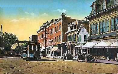
Glen Cove Railroad
| Company type | Private company |
|---|---|
| Industry | Transportation (Trolley) |
| Founded | 1870 |
| Headquarters | Babylon, New York , United States |
Area served | Babylon, New York and surrounding areas |
| Products | Horse-drawn trolley service, later electric trolley lines |
Babylon Railroad
The Babylon Railroad Company was established in 1870, initially operating a horse-drawn trolley service connecting the South Side Railroad's Babylon Station to the Fire Island Ferry. Following the inauguration of the Central Railroad of Long Island in 1873, passengers could board the horsecar at the Watson House to reach the Great South Bay. In 1910, a second route was introduced, linking Babylon Station with Amityville.
| Name | From | Route | To | Notes |
|---|---|---|---|---|
| Fire Island Line | Babylon Station | Deer Park Avenue and Fire Island Avenue leading to the ferry at Great South Bay | Great South Bay Ferry | Service discontinued May 15, 1920 |
| Amityville Line | Babylon Station | Trolley Line Road and Union Avenue | Amityville (station opened 1912) | Service discontinued May 15, 1920 |
Cedarhurst Railway
The Cedarhurst Railway provided transportation from Woodmere (Long Island Rail Road station) to Brosewere Bay, catering to patrons of the Rockaway Hunt Club and the Rockaway Steeplechase Association.
| Name | From | To | Route | Notes |
|---|---|---|---|---|
| Cedarhurst Railway | Woodsburgh Railroad Station | Brosewere Bay | Wood Lane, Railroad Avenue, Rutherford Lane | Service terminated in 1894 |
Echo Line Railroad
The Echo Line trolley operated between Port Jefferson Harbor and Port Jefferson Station within the Hamlet of Echo, New York. This line was acquired by Suffolk Traction Company for integration into its main Patchogue route but ceased operation following Suffolk Traction's financial failure.
| Name | From | To | Route | Notes |
|---|---|---|---|---|
| Echo Line | Port Jefferson Harbor | Port Jefferson Station | Main Street, East Main Street, East Broadway | Discontinued in 1919 |
Freeport Railroad Company
The Freeport Railroad Company ran a year-round trolley service in Freeport, New York. It leased a segment from the Great South Bay Ferry Company between Front Street and Ellison’s dock; both companies were frequently under common management. Operations commenced on August 5, 1913, concluded around November 8, 1917, and the route was sold to Great South Bay Ferry on July 13, 1918.
| Name | From | To | Route | Notes |
|---|---|---|---|---|
| Fishermen's Delight | Freeport LIRR station | Nautical Mile | Grove Street (currently Guy Lombardo Boulevard), Front Street, then southward to Ellison's dock on Little Swift Creek; included a private right-of-way between Miller Avenue and South Ocean Avenue | Connected ferry service to Point Lookout; sold in 1918; replaced by n62 bus via Guy Lombardo Boulevard (discontinued 2017) |
Garden City Shuttle
During the early 1900s, the Long Island Rail Road operated a trolley line along the former Central Railroad of Long Island#CRRLI Main Line route between Garden City Station and Plainedge from 1915 until 1933. A connection to Country Life Press station was added in 1927. These trolleys were eventually supplanted by MP41 cars and later by PRR MP54#MP54 models.
| Name | From | To | Route | Notes |
|---|---|---|---|---|
| Long Island Rail Road | Garden City Station | Salisbury Plains | Central Branch line | Terminal shifted in 1927 to Country Life Press station |
| Long Island Rail Road | Country Life Press Railroad Station | Salisbury Plains | LIRR Central Branch | Trolley service replaced by MP41 cars in 1933; subsequently replaced by MP54 cars in 1949 |
Glen Cove Railroad
The Glen Cove Railroad was one of two trolley systems that began at the Sea Cliff Railroad Station, traveling northward alongside the LIRR tracks to Glen Street station. From there, it navigated a winding path through the streets of Glen Cove. This line operated between 1905 and 1924 before being discontinued. Today, portions of its former route align with segments of the n27 bus line and Glen Cove's bus loop.
| Name | From | To | Route | Notes |
|---|---|---|---|---|
| Glen Cove Railroad | Sea Cliff Railroad Station | Glen Cove Waterfront | Right of way, Glen Street, School Street, Cottage Row, Mill Street, The Place, Ellwood Street, Clement Street, Carpenter Street, Landing Road | Service ceased in 1924; route now divided among current bus operations. |
Great South Bay Ferry Company
The Great South Bay Ferry Company operated a seasonal trolley service in Freeport, New York, linking ferry operations to Point Lookout, New York. Originally owned by the Long Beach Transportation Company and leased to the ferry company in 1905, the trolley line extended from Atlantic Avenue to Ellison’s dock by 1906. In 1907, it was incorporated into the Seashore Municipal Railroad Company holding group; later that year Long Beach Transportation merged into this entity. The holding company dissolved by 1913. The southern portion of the route was leased to the Freeport Railroad Company, which shared management with the ferry company. By 1918, the ferry company had full ownership of this trolley line. Service likely concluded around September 1921. The former trolley corridor has since been redeveloped into residential condominiums and was partially served by the n62 bus until that route was discontinued in 2017.
| Name | From | To | Route | Notes |
|---|---|---|---|---|
| Great South Bay Ferry Company | Freeport Atlantic Avenue | Nautical Mile | Atlantic Avenue southward to Ellison's dock on Little Swift Creek via private right-of-way between Miller Avenue and South Ocean Avenue | Connected ferry service to Point Lookout, New York. Abandoned in 1921; corridor now residential; n62 bus service ended in 2017. |
| Fishermen's Delight | Freeport LIRR station | Nautical Mile | Grove Street (currently Guy Lombardo Boulevard), Front Street south to Ellison's dock via private right-of-way between Miller Avenue and South Ocean Avenue | Acquired in 1918; service ended 1921; replaced by n62 bus (discontinued 2017). |
Huntington Railroad
Established on July 19, 1890, the Huntington Railroad initially operated a trolley line connecting Huntington Village and Halesite. It eventually extended its service to include the Huntington Railroad Station and followed much of what is now the NY 110 corridor through areas such as Melville and Farmingdale, ultimately reaching the docks at Amityville.
| Name | From | To | Route | Notes |
|---|---|---|---|---|
| Huntington Railroad | Halesite | Amityville | Wincoma Drive, East Shore Drive, New York Avenue, Walt Whitman Road, Amityville Road, Broad Hollow Road, Conklin Street, Main Street (Farmingdale), Broadway, Sterling Place, Greene Street, Bennett Place, Richmond Avenue | Operations ceased on September 23, 1919. The corridor later evolved into today’s S1 bus route. |
Huntington Traction Company
The Huntington Traction Company took over from the Huntington Railroad Company, continuing service along the original route connecting Huntington Railroad Station to Halesite. Service was confined to the area south of Jericho Turnpike until the line ceased operations in 1927.
| Name | From | To | Route | Notes |
|---|---|---|---|---|
| Huntington Traction Company | Halesite | South Huntington | Wincoma Drive, East Shore Drive, New York Avenue, Walt Whitman Road | Service discontinued in 1927. The northern portion aligns with today’s S1 bus route. |
Nassau County Railway
The Nassau County Railway provided transit from the Sea Cliff Railroad Station through the Village of Sea Cliff to the summit of a cable railway incline leading down to the dock. This trolley operated between July 2, 1902, and December 31, 1924.
| Name | From | To | Route | Notes |
|---|---|---|---|---|
| Sea Cliff Railroad Station | Sea Cliff Landing | Sea Cliff Avenue, Glen Cove Avenue, Glen Avenue, Main Avenue, Twelfth Avenue to Prospect Avenue near the incline | Discontinued in 1924; incorporated into present-day n21 bus service. |
New York and Long Island Traction
The New York and Long Island Traction Company operated lines extending eastward to Freeport, Hempstead, and Mineola within Nassau County.
| Name | From | To | Route | Notes |
|---|---|---|---|---|
| Mineola Line | Queens Village (transitions to Long Island Electric Railway at Queens-Nassau boundary) | Mineola | Jamaica Avenue | Operations ended April 3, 1926; currently served by n24 bus route. |
| Jamaica-Hempstead Line | Jamaica (transitions to Long Island Electric Railway at Queens-Nassau boundary) | Freeport | 160th Street (Jamaica) to Belmont Park via 160th Street, Jamaica Avenue, Hempstead Avenue (Turnpike) | Shared service between NY&LI and LIER; ceased April 3, 1926; replaced by n6 bus. |
| Brooklyn-Freeport Line | Brooklyn (transitions to Long Island Electric Railway at Queens-Nassau boundary) | Freeport | Rockaway Boulevard, North Conduit Avenue, Sunrise Highway | Service terminated April 3, 1926; now operated by n4 and n36 buses. |
New York and North Shore Traction
The New York and North Shore Traction Company ran routes from northeastern Queens into Nassau County. Established in 1902 as the Mineola Roslyn & Port Washington Traction Company, it adopted its later name in 1907.
| Name | From | To | Route | Notes |
|---|---|---|---|---|
| North Shore Line | Flushing, Queens | Roslyn | 35th Avenue, 39th Avenue, Northern Boulevard | Discontinued in 1920; presently served by n20 bus route. |
| Port Washington Line | Port Washington | Mineola | Main Street (Port Washington), Port Washington Boulevard, Middle Neck Road (Flower Hill), Old Northern Boulevard, Main Street (Roslyn), Roslyn Road, Railroad Avenue, Warner Avenue, Mineola Avenue, Willis Avenue | Abandoned in 1920; corresponds with current n23 bus service. |
| Hicksville Line | Mineola | Hicksville | Westbury Avenue, Maple Avenue, Post Road, Union Avenue, Prospect Avenue, West John Street | Ceased operations in 1920; partially overlaps with today’s n22 bus route. |
Northport Traction Company
The Northport Traction Company provided service from the Northport East Railroad Station to the heart of Northport Village.
| Name | Origin | Destination | Pathway | Remarks |
|---|---|---|---|---|
| Northport Traction Company | Northport East Station | Northport Village | Larkfield Avenue, Laurel Avenue, Main Street, Woodbine (Cherry) Avenue adjacent to Northport Harbor. | Ceased operations in 1924; portions of the route are currently covered by the HART H40 bus line. |
South Shore Traction Company
Situated in Sayville, New York, the South Shore Traction Company aimed to extend its network to Patchogue and further north through Bohemia, Lake Ronkonkoma, St. James, and Stony Brook en route to Port Jefferson, along with expansions into Nassau and Queens Counties. Due to the Long Island Rail Road's dominant presence in Nassau County, it was compelled to transfer its initial two lines to the Suffolk Traction Company.
| Name | Origin | Destination | Pathway | Remarks |
|---|---|---|---|---|
| Sayville Railroad Station | Sayville on the Great South Bay | Railroad Avenue, Montauk Highway, Candee Avenue | Taken over by Suffolk Traction Company and subsequently discontinued; currently incorporated into S57/S59 bus routes. | |
| Bayport-Blue Point Line | Sayville Railroad Station | Blue Point | Middle Road, Oakwood Avenue, Railroad Street/Maple Street, Blue Point Avenue, Montauk Highway | Acquired by Suffolk Traction Company and later abandoned; presently served by S40 bus route. |
Suffolk Traction Company
The Suffolk Traction Company operated trolley services connecting Patchogue, Canaan Lake, and Holtsville within Suffolk County. Its network also included stops at Medford, Blue Point, Bayport, and maintained a connection with Sayville. The Sayville and Bayport-Blue Point Lines were initially developed by the South Shore Traction Company. Although plans existed for expansion toward Port Jefferson—featuring a bridge over the LIRR Main Line—as well as extensions to Bellport and Brookhaven, these projects were never realized.
| Name | Origin | Destination | Pathway | Remarks |
|---|---|---|---|---|
| Main Line | Patchogue Railroad Station | Holtsville | South Ocean Avenue, North Ocean Avenue, Old North Ocean Avenue, Suffolk Traction Boulevard | Discontinued; sections north of Canaan Lake have been removed. |
| Medford Line | Patchogue Railroad Station | Medford | Likely following present-day NY 112 | Abandoned; partially replaced by today's SCT 55 bus service. |
| Bayport-Blue Point Line | Sayville Railroad Station | Patchogue at Medford Avenue | Middle Road, Oakwood Avenue, Railroad Street/Maple Street, Blue Point Avenue, Montauk Highway | No longer in service; formerly connected Bayport and Blue Point; now integrated into SCT 2 bus route. |
| Sayville Line | Sayville Railroad Station | Sayville on the Great South Bay | Railroad Avenue, Montauk Highway, Candee Avenue | Discontinued service. |
See also
References
- Images of Rail: Lost Trolleys of Queens and Long Island, authored by Stephen L. Meyers (2006).
External links
- Long Island Overview
- Huntington Area
- Northport Region
- Nassau and Queens Areas
- Sayville-Patchogue-Holbrook Corridor
- Suffolk County
- Patchogue-Medford Library Local History Department